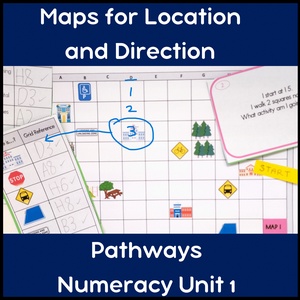
VCE Pathways Unit 1 Focus Area Location Maps and Task Cards Learning Pack

Resource Description
Using modified maps are a great way to build location skills for older students in Pathways Numeracy Unit 1. This unit requires students to understand space, direction and location in relation to highly familiar local places. They need to to follow simple and familiar directions to locations that they know, and have a sense of their own place in space. The focus area 'Location' allows for print or digital maps to be used as skills are developed.
We can use clear, explicit teaching to help students master the language of location, orientation and place, and to understand how to use a map to find a location and give directions. Provide frequent practice that is scaffolded so students build their independence over time, until they are able to confidently give and receive directions within their own community. Encourage them to ask and answer questions, work in pairs or small groups, use key words such as 'turn, left, right, north, south, next to, in front of).
What's inside?
9 full colour maps - print these in landscape format
Question sets (print 3 to a page in landscape format then cut and share with individual students or small groups). Question sets include:
- 7 question sets with a picture cue plus ‘Where is?’ (grid reference) prompt
- 2 question sets with a picture / symbol cue plus ‘Where is? (street name) prompt
- 9 question sets with a grid reference plus ‘What is in?’ prompt
- 9 question sets with a ‘Can you find?’ (place name) question prompt and grid reference answer
- 36 worded question cards (print 4 to a page in landscape format)
Maps in the community – fast facts printable
Maps in the community –word bank printable
Places in my community – matching words and clues
Maps in the community – word find (across and down words only, no backwards or diagonal text)
In my community student activity printable
How to find a grid reference square student information page
How to find a grid reference with a ruler student information page
How to follow directions student information page
Making a story map information page, student activity page and example
Full answer sets for all questions and activities included
What to do?
•Introduce map skills in relation to the students’ own community, discussing how symbols and pictures can be used to represent places (shops, libraries, hospitals, movie cinemas etc)
•Use the word bank and fast facts pages introduce key mapping concepts
•Provide examples from your own local community – printables of a department store or brochures from a local information or tourist bureau can be useful as a display
•Teach simple map skills using grid references – use the printables included to show how to read a grid reference step by step, using a ruler for support if needed
•Practice locating places on a map by looking for key words, finding symbols and reading grid references
•Introduce street names and reading text across and down the page
•Introduce language of direction and place finding (left, right, straight ahead, turn) as well as cardinal directions (north, south, east west)
•Provide opportunities for practice using modified maps of increasing complexity
•Apply map reading and directions to a local community context, with lots of positive feedback and reinforcement as skills are applied to finding real places on real world maps when students are ready.
Extend the learning:
Extend the map skills in your life skills class by asking students to visit an online map to find directions to a local venue of interest. Print and follow the steps to visit the venue as a community activity.
Plan a scavenger hunt in the school or training venue grounds using the language of direction and place finding (e.g. walk 20 steps towards the cafeteria towards the library, then turn left at the red sign)
Curriculum links:
This resource can be used to support the following unit:
Victorian Pathways Numeracy Unit 1 Personal Numeracy Module 1 Focus Area Location