
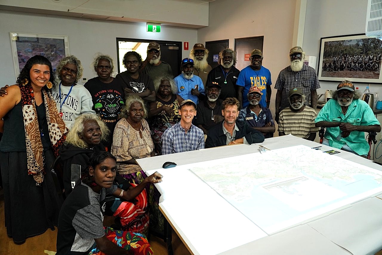
For the last two-and-a-half years, PhD candidate Sam Williams has worked with elders to create 25 videos telling stories about important places on their ancestral Country, from Arla (Junction Bay) to Yinangarnduwa (Cape Stewart), in six different languages.
Along with the videos, Williams and the Elders have gathered clan and location names, and archival information from old anthropologists.
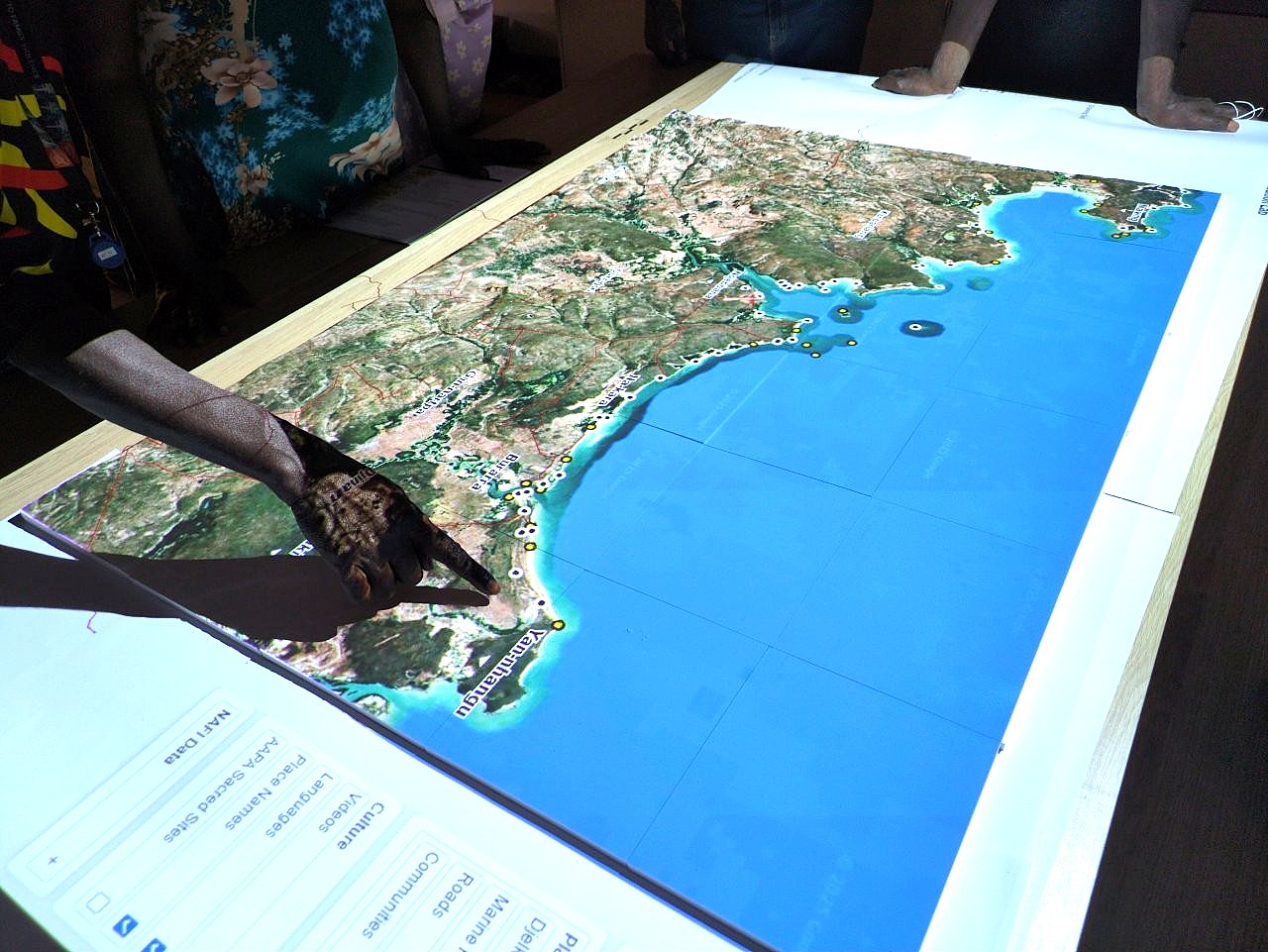
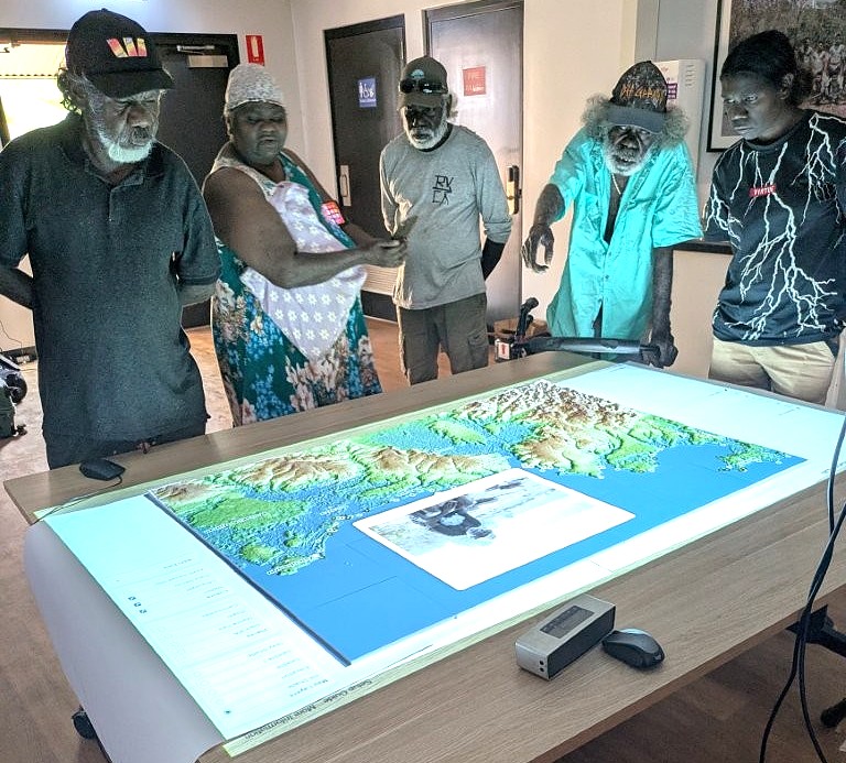
The model is a 3D printed map the size of a large table, with a projector over the top that brings the map to life.
The user can choose to display different layers so that you can see roads, outstations, elevation, river catchments and floodplains or satellite imagery.
What’s really special about the model is the knowledge input by the elders.
“I’ve been working with people who remember canoeing up and down the coastline as children from camp spot to camp spot, and living on their country with elders who taught them how to survive and how to thrive, really,” Williams explains.
“And they just want to do whatever they can to leave some sort of legacy of that to children who are mainly growing up in a town and don’t have nearly as much opportunity to interact with their country as maybe they did when they were younger.”
“Times have changed in Arnhem Land, but they want to leave some sort of legacy behind – and this is one part of that, it’s a small work towards that end.”
PhD candidate Sam Williams, middle front in cap, has been excited by the response of Indigenous teachers at Maningrida College, whom he says ‘have a bazillion different ideas’ about what to do next with it. PHOTO: Dave Mason
Williams grew up in East Africa and did most of his schooling in Kenya, before his family migrated to Australia and he completed his university years at Monash University in Melbourne.
He arrived in the Territory six years ago to work as an anthropologist for a land council, doing applied work on land rights, native title, basically supporting Indigenous groups to make claims to land and then to exercise the rights that they have as landowners.
He did that for four years during which time he got to know a group of Maningrida elders, who were keen to do a project that supported the transmission of their knowledge from one generation to the next – and so the idea for his PhD hatched and it kicked off in 2023.
The idea of the map isn’t that the school uses it just on their own, but that they invite elders in and it’s a space around which those intergenerational conversations can happen.
“It’s kind of like a performance space in a way,” Williams says.
“There are little digital pins on the map of all the places we have made a video, so you can ‘click’ on a pin, and a video pops up of an elder sitting at that very place and telling a story about it,” he shares.
“You can click on the place ‘Amala-Arawirr’ and see Samuel Gulwa telling the ancestral story of how a hollow log coffin washed down the Goomadeer River in a flood and came to stop in Junction Bay, where it can be seen now as a dangerous sacred site.”
The map, which contains more than three hours of video footage, was delivered to Maningrida College’s Lùrra Language and Culture Centre, which will integrate the resource into the cultural curriculum of the school.
“Anyone who wants to – children, elders, teachers or community members – can go there and use the map, watch videos, learn the names of places or just look at Country from a different perspective,” Williams says.
“The Lùrra Language and Culture team, made up of Indigenous and non-Indigenous teachers, had loads of thoughts about how they could use the map within their curriculum and add to it over time. It was great to see the ownership taken of this resource.”
Undertaking the project has been a labour of love for the young academic, and no easy task involving helicopters, boats, four-wheel drives, long trips out in the bush to remote and mostly inaccessible places, and talking to the people who are connected to that land.
“When we actually delivered the 3D map to the school, once they could see it in person – you know, it’s all well and good to say, ‘oh, there’s a 3D map and it’s interactive’, but when you actually can touch it and play with it and use it and you get the vision of what it can do, I think so many of the teachers have been really, really enthusiastic about how they can use it in the classroom,” Williams enthuses.
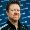
Dr Rohan Fisher is a senior research fellow at CDU’s Northern Institute and has used his experience with 3D printing and projection, augmenting landscapes to create the model.
Fisher has worked extensively to generate 3D simulation tools for rangers, emergency services and schools, and says the cooperation showed how combining expertise could produce meaningful results.
“Anyone who wants to – children, elders, teachers or community members – can use the map, watch videos, learn the names of places or just look at Country from a different perspective,” Sam Williams says. PHOTO: Dr Rohan Fisher
“It was a wonderful example of a collaboration where Sam had already done the years of hard work with people on Country but needed a way to make sure all this hard work was brought back to the community, and particularly the young people,” Fisher says.
“The project’s an excellent example of how some appropriate tech can elevate stories and knowledge.”
Williams has been excited by the response of Indigenous teachers at Maningrida College, whom he says ‘have a bazillion different ideas’ about what to do next with it.
The 3D map is now owned by the school and Williams and his team have committed to giving as much support as the school requires to input more elements into it over time.
“So the school has its own archives of things they’ve done over the years and they’ve started to put those into the map, too, including, a learning on country project.
“They were working this year on traditional fish traps at a few different particular outstations. So they’ve started to input photos and videos of that, which they’re going to integrate into the 3D map.”
The Australian Institute of Marine Science have also provided some offshore baited camera work that was done in partnership with parks rangers, and that’s been added as well.
“You can click on some of these offshore sites and it pops up with a video of what you see underwater, so sharks and different kinds of marine life, turtles, stingrays, all kinds of stuff.
“So as well as the cultural learning, there’s endless applicability, it just depends on what you want to do with it, really.”
The 3D map itself is actually remarkably cheap.
“It sounds like pretty amazing technology and it is, but to 3D print the map was only a couple of thousand dollars,” Williams says.
The creation of the 3D map and interface was funded by Maningrida College, the Bawinanga Rangers and the Northern Institute, while research and fieldwork to film the videos was supported by funding from the Federal Government as part of the Our Marine Parks grant program from Parks Australia.